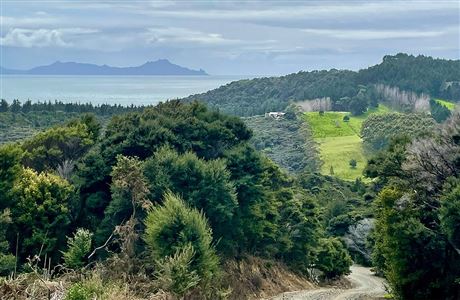
For amazing views of the countryside and coastline, follow this track along the ridgeline of the Brynderwyn range.
The Brynderwyn range is one of the most prominent geographical features between Whangārei and Auckland. The Brynderwyn hills stretch from the Mangawhai Heads on the east coast nearly halfway to the eastern arms of the Kaipara Harbour.
Duration: 3 hr
You can access the Langsview Track from either its eastern or western end, or via one of the other Tanekaha tracks from the south.
MAP CLICK BELOW
https://www.doc.govt.nz/map/index.html?banner=0&layerlist=0&base=Topo&layers=Walking%20and%20Tramping&extent=1737974.7860000003,6007891.137700001,2193,13&search=Walking%20and%20Tramping:23fcb04a-f0dc-4555-b4f2-8446ea375368
Eastern entrance: The Eastern entrance is along Cove Road just south of Bream Tail Road. There is a carpark here and a short bush walk that leads to the track itself.
Western entrance: The western entrance is at the top of Cullen Road where it intersects with a forestry road. Cullen Road runs off Cove Road between Waipu and Waipu Cove. It’s also a section of the Te Araroa Trail. If driving to this point, park before the water tanks. The track entrance is signposted and the track follows a private access road for resident’s vehicles only.

Rate us and Write a Review
January, 2026
Monday
August 26,2019
- Tuesday
- 9:00am - 10:00am
Awesome Job!
We have received your appointment and will send you a confirmation to your provided email upon approval.


